SALT LAKE CITY – Due to the increasing salinity issues related to the shrinking Great Salt Lake, the Division of Forestry, Fire and State Lands, along with the Division of Water Resources, modified the breach in the Union Pacific railroad causeway that divides the lake. The breach is a 180-foot section of the causeway that was removed to connect the north and south areas of the Great Salt Lake with an open channel.
The decrease of incoming water into the lake has created a salinity issue that has negatively impacted the lake’s ecosystem.
“The salinity of Great Salt Lake plays an important role in shaping the lake’s unique ecological, recreational and mineral resource use,” said Laura Vernon, Great Salt Lake Coordinator for the Division of Forestry, Fire and State Lands. “Unfortunately, the decrease in freshwater inflows has led to an increase in salinity that is detrimental to these resources.”
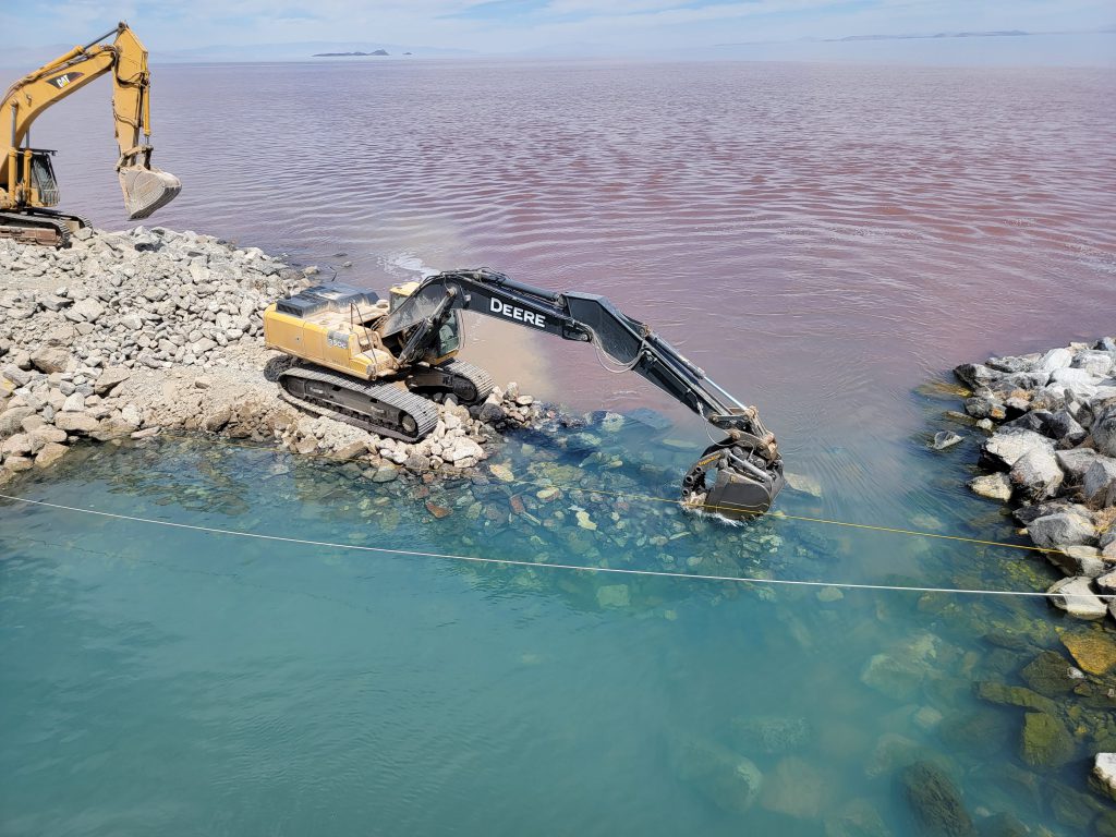
In recent years, the north arm was causing the salinity level of the south arm to increase. This increase poses an environmental threat to the brine shrimp in the south arm and the migratory birds that feed off the shrimp. Engineers from the Division of Water Resources prepared a design to raise the berm in the bottom of the causeway breach by four feet. This would reduce the mixing of the north and south arms. The berm was constructed at the end of July.
“It’s exciting to see this project designed and constructed so quickly to help manage the salinity levels,” said Eric Dixon, Design & Construction Section Manager at the Division of Water Resources. “Initial readings indicate that the completed work is significantly reducing the flows of the higher salinity waters through the bottom of the channel.”
The water in the lake’s north arm is heavier than the water in the south due to the lack of freshwater inflows and higher concentrations of salt, so it pushes into the south arm along the bottom of the channel. The less-dense water in the southern arm slides over the heavier north arm water at the causeway breach. The berm modification is intended to significantly reduce north-to-south flow but still allow south-arm water to flow north.
Southern Pacific built the causeway in 1902 as an alternate route to the original rail line laid through the Promontory Mountains north of the lake. In 1959, the 12-mile wooden bridge section was replaced with the current rock-filled causeway, which included two culverts that allowed water to flow freely. Due to the slow settling of the causeway into the lake bed, the culverts eventually sank low enough that they had to be abandoned and filled in, which slowed the water flow between the two arms. In 2016, the causeway was breached to restore the flow between the north and south arms, and to improve rescue boat access to the north arm.
With the installation of the raised berm, state officials and United States Geological Survey personnel will continue to monitor the salinity levels of the lake to determine if additional work is required in the future.
###